Contents
|
Suggested additional reading:
Prehistoric Troglodytic Village
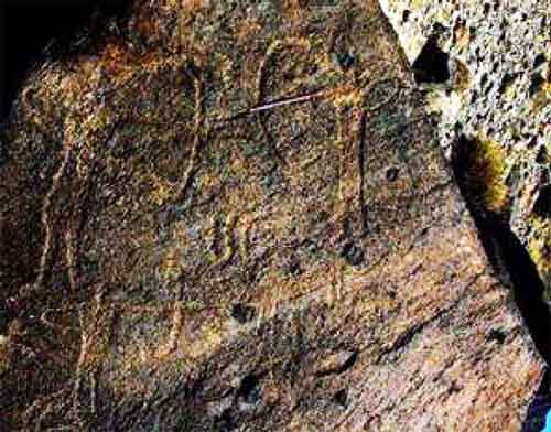 |
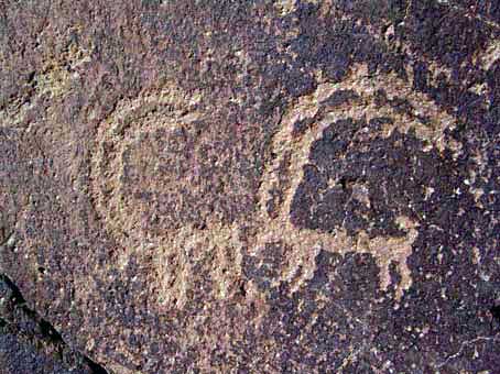
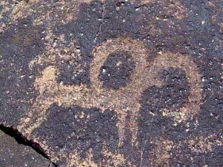
Rock art from Gorgondar near Meymand / Maymand. Hunters with bows and arrows.
This image was one of the first examined by a European, French anthropologist
A. Leroi-Gourhan, who estimated the art to be 12,000 years old. |
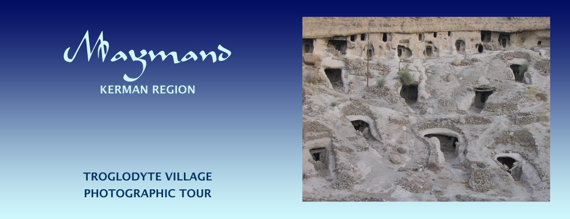
Meymand (also spelt Maymand and Maimand) is a village of troglodytes - cave dwellers - located in the south-eastern Iranian province of Kerman.
Meymand (Maymand, Maimand) village has been continuously inhabited for 2,000 to 3,000 years making it one of Iran's four oldest surviving villages. By contrast the troglodytic village of Kandovan in northwest Iran is said to have been inhabited for 700 years. Some claim that Meymand / Maymand village has been inhabited for 12,000 years, that is, since the middle stone ages, making it a mesolithic village. Reportedly, 10,000 year old stone engravings and 6,000 year-old pottery have been discovered at the site.
The village is a UNESCO world heritage site and was awarded UNESCO's 2005 Melina Mercouri prize. UNESCO compares Meymand / Maymand with villages of Kandovan, Hille Var, Sour, Ghorveh, Vind, Tamin, Kharg Zoroastrian hypogea, Zoroastrian houses around Tabas, Jahlkhaneh in Bushehr, Kapadocia, Metra, some regions in south of England, Jordan and China.
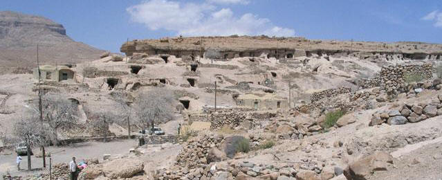 |
| Meymand / Maymand village. Image credit: Fotopages |
While many Iranian desert villages are fairly non-descript in appearance most of the time (their beauty is found within the courtyards and homes), Maymand is in comparison stark in appearance and perhaps even unattractive in the usual sense. The villagers have done little to add colour to the natural earth tones of the landscape. Their homes and streets have no potted flowers or ornamental plants. The village's stark appearance is complimented by Spartan life of its inhabitants. Adults wear sober coloured clothes and visitors have noted in their travel logs that they could hear no music.
The village has a present peak population of between 130 and 150 people many of whom are semi-nomadic shepherds, living in the village caves during the winter when the population is at its highest and migrating to higher pastures in the summer leaving about 60 residents in the village.
Links to Zoroastrian and Pre-Zoroastrian Customs
According to local tradition, Maymand was a Zoroastrian settlement before the advent of Islam and that prior to become Zoroastrian, the residents worshipped the sun. (We have not come across reports about the villagers' present beliefs.)
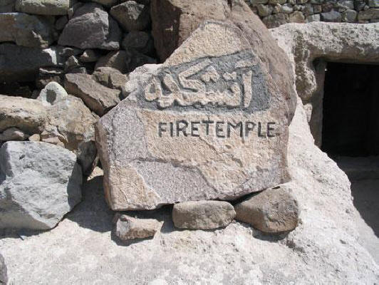
One of the cave units is that is now a museum has a sign post stating that was an Atash-Kadeh, a fire temple [also called Kicheh Dobandi, kicheh means cave-dwelling (see
Construction of the Cave Dwellings below) and dobandi means two bands perhaps signifying two enclosures], and there are claims that the ancient inhabitants also worshipped pre-Zoroastrian Mithraism.
It is said that the original inhabitants did not bury their dead, but placed them in crypts carved into the mountainside. In addition, the village contains a 400 square metre complex of fifteen circular rooms where bones and personal belongings have been found, suggesting that it too was used as a crypt or even an ossuary.
The local language retains elements of Sassanian Middle Persian (sometime called Pahlavi).
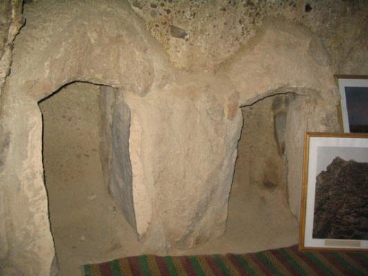 |
| Fire temple nook for a brazier. Image credit: Fotopages |
|
Location
|
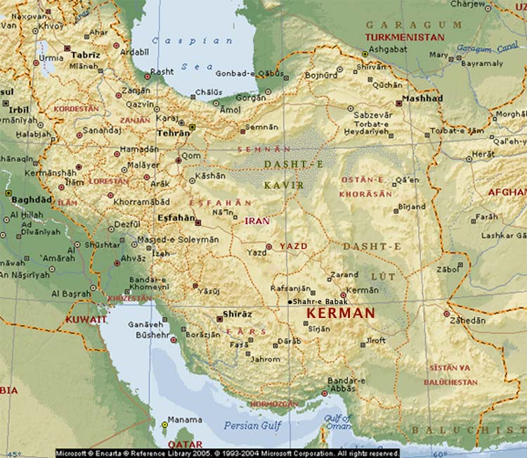
| Map of Iran. Base map credit: Microsoft Encarta |
|
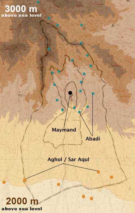
Migration range of Maymand nomads
Black dot = Maymand (winter residences)
Blue dots = Abadi (summer, mountain residences)
Orange squares = Aghol / Sar Aqul (spring, plains residences) |
Maymand / Meymand village is located some 35 kilometres northeast of the town of Babak - Shahr-e Babak, a Kermani town on the road that runs between Tehran in the north and the port of Bandar Abbas in the south. Shahr-e Babak means Babak's city and Shahr-e Babak is said to be the birthplace of the founder of the Persian Sassanian dynasty c.200 CE (see Timelines). The road from Shahr-e Babak rises into the surrounding mountains until it reaches
Maymand at an elevation of 2240 metres.
Layout & Facilities
We do not know if any of the cave units have been adapted from natural caves, for most of the cave dwelling units have been dug out by hand. The cave units line two sides of a shallow valley and in some areas, the cave apartments are five stories high.
The are a total of 406 residential cave units with a total of 2560 rooms. A large number of the units have been abandoned.
The community structures include a bath (a hammam), public toilet, school, restaurant, museum, store and handicrafts store. While there is an eight-roomed guest house called the Meymand Guesthouse near the entrance to the village, visitors can sometime find lodgings with some of the residents. Travellers (cf. Lonely Planet) report that the guesthouse rooms have "namad (pressed wool felt) carpets on the floors, beds carved into the walls and warm lighting, it's easy to be transported to another time. Bathrooms are shared but clean, with steaming (hot water) showers."
Climate, Water & Vegetation
The winters in Meymand are cold and harsh. The summers are hot and dry. Rainfall is variable, fluctuating between 300 and 500 mm per annum.
The village is supplied with water by two underground kareez (qanat) aqueducts that bring water down from the water catchment areas on the upper slopes of the surrounding hills.
Local vegetation consists of hardy plants and wild mulberry, pistachios and almonds trees. According to UNESCO, "the ravines (surrounding Maymand) are dotted with tiny oases where hazel trees, vineyards, jujubes, almonds and other trees are grown. The oases are surrounded by tilled fields some of which have suffered from successive periods of drought."
Living & Livelihood
|
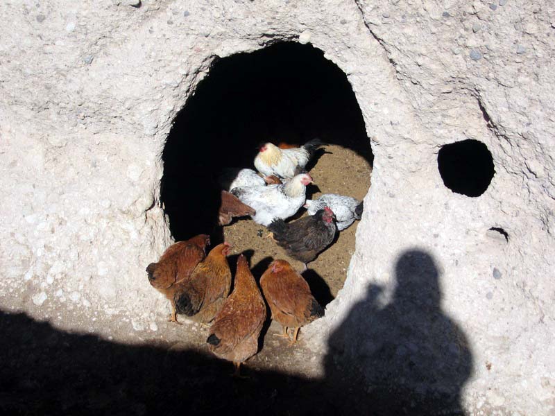
Chicken coop hewed out of the sedimentary rock. Note the rock's concrete-like appearance with embedded stones.
Image credit: dmehrtash at Flickr |
The economy of the villagers is based on agriculture, herding, animal husbandry, carpet weaving and tourism. The orchards consist of pistachio, almond, walnut, and pomegranate, and mulberry trees. Meymand's carpets have an international reputation. Carpet weaving spawns supporting and ancillary crafts such as dyeing, felt-making, kilim-weaving (kilims, also spelt gilims or gelims, are flat tapestry-woven carpets or rugs), and crochet lace work.
Meals consist of flat bread, yogurt and a thin soup made from milk and dried herbs. The custom is to tear the bread into bit-sized pieces and throw them into the bowl of soup. The meals supplemented by a diet of dairy products, nuts and traditional breads. Eggs are a treat and meat is eaten on especial occasions only. The diet while simply is nevertheless healthy and nutritious.
The villagers are learning to take advantage of tourists and some of Meymand's elderly women have begun to sell local woven baskets and wild herbs. They also sell, for about IR60,000 in 2008, traditional nomad hats made from a handmade felt called namad - a matted felt made by soaking and pressing together wool.
Annual Migration
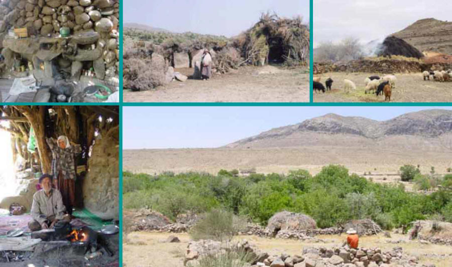
A little over half of Meymand's population leads a semi-nomadic life, dwelling in the caves during the winter, moving with their herds of goat & sheep to the plains in the spring and then to higher pastures and cooler climes during the summer. The nomadic range is about 120 square kilometres with Meymand at its centre.
The nomads spend their winter months in Maymand, living in their cave homes with the women weaving carpets and the men tending to the herds.
In the spring they move to the lower plains as the grass in the pastures will have started to grow here first. The spring camps are, according to UNITAR (UN Inst. for Training & Research) twelve (another source, Kiarash Eghtesadi, director of Maymand's research center, says eight) designated areas called aghols or sar aquls. Some nomads choose to camp at the foot of the hills in camps called eshams. Each residences is owned by a family.
During the summer, the weather in the plains and Meymand gets quite hot and the nomadic herders find relief from the heat as well as fresh pastures in the higher altitudes around Meymand. There they also harvest wild herbs and stay until early autumn. The mountain camp areas are called abadis and house up to 40 nuclear family units. There are, according to UNITAR 38 (35 according to Kiarash Eghtesadi) abadi sites dotting the hillsides.
Those residents that remain in the village occupy themselves with animal breeding and the tending of the orchards.
Medicinal Herbs - the Haoma Tradition
|
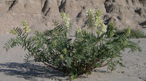
| Astragalus Racemosus |
Amongst the wild plant found in Meymand's surroundings are herbs such as the astragalus plant which is considered a medicinal herb and whose stems have sometimes been used in haoma preparation (also see our page on haoma) in Yazd and Kerman.
During the summer, while their herds graze on the pastures on the higher slopes, the herders collect wild nuts, seeds and medicinal herbs such as wild pistachio, almond, walnut, cumin seeds, black thyme, rosemary, yarrow, cumin, hollyhock, buttercup, fennel, peppermint, liquorice, and London rocket seed.
On their return to the village, the residents make their herbal harvest available to others. Visitors can receive advice and herbal remedies based on generations of experience. Salma is one such herbal advisor. The fact that in 2008, her mother was 97 and her father was 115 years of age is a testament to the efficacy of their remedies, connection with nature, and their diet.
Construction of the Cave Dwellings
As we have noted above the cave dwelling units have been made by burrowing into the hillside's soft sedimentary rock deposited in layers during the Mesozoic age some 100 to 200 million years ago. Sedimentary rock is a rock formed on the earth's surface. It is formed by a sea or glacier carrying and depositing as sediment eroded rock from elsewhere as a strata. The sediment usually sits on top of harder rock formed within the earth and gradually hardens. The concrete-like consistency of the Meymand's sedimentary rock is soft enough to be shaped by manual labour while still being hard enough to support the roofs of the cave units.
The individuals cave dwelling units are about 2 metres high and have an area of around 16-20 square metres. The construction of a cave dwelling called a kicheh starts with the chiselling of 6 to 9 meter horizontal cuts into the cliff-side [see Farzaneh Soflaei's paper Organic Architecture.... (Sanadaj, 2008)]. There are presently some 400 kichehs /dwellings in Meymand. The dwellings usually consist of a single square or round room. Windows where possible are hewed openings approximately 75 cm across. Otherwise, the dwellings are windowless and dark not just because of the lack of natural light but also because of the soot from fires and candles that coat the walls. Some dwellings have more than one room and even an attached stable or animal shelter.
Doors to the dwellings are commonly made of wood and fitted with a secured latch known as koleydun which locks onto a hole drilled into the stone frame. Not all the doors are rectangular. Some have the shape of s standing human body, narrower at the base and widening a the top to shoulder width. To prevent water egress, the threshold of the doors are raised some 15 to 20 cm. above the level of the kicheh.
Since the lower slopes have a shallow gradient, the entrance to the units is often preceded by a trench whose walls rise until the hillside is tall enough to accommodate a dwelling unit. At times the lower cave dwellings are grouped like town houses so that the entrance trenches of up to five dwellings open onto a terrace known as a dalan. The dalans are used for family and social gatherings.
Other Types of Dwellings
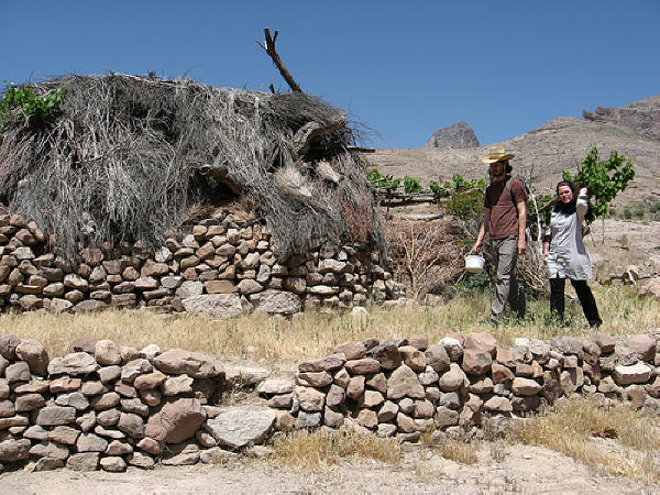
The round rock from glacial deposits have been used by the villagers to build dividing walls and buildings especially on the valley floor.
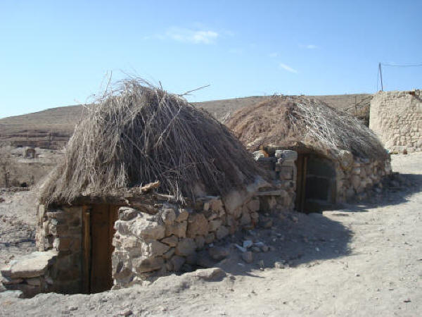
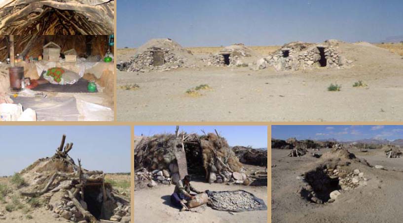
Some of the residents who maintain their residence in the village during the summer (that is, those who do not migrate higher up the mountain slopes to cooler climes), construct summer dwellings called kapars. The kapars are constructed in a manner that allows air to circulate, creating a draft and some relief from the heat. Another type of structure is called a gonbeh or gambeh - a circular stoned wall house with a conical roof made from wooden rafters and covered by earth. According to Kiarash Eqtesadi, director of Maymand's research center, the interior of a gonbeh / gambeh is not as cool as inside of a kapar.
The shelters built by the nomads in the abadis, sar-aquls / aghols and eshams are built from wood and stone without the use of mortar.
The aghols are constructed as semi subterranean buildings, half below ground and the other half above ground, similar in appearance to a gonbeh / gambeh. The abadi are built above ground.
In addition to the stone and wood structures, the Maymandi also erect tents called pollas. The pollas tents are made from a whitish fabric where the vertical threads are made from cotton and the horizontal thread are made from goat's wool.
Rock Art
[Note; A petroglyph is rock art made by scratching the surface of a rock exposing the layer underneath. A pictograph is a drawing or painting on rock.]
Rock art can be found in and around Maymand. Three kilometres northeast of Maymand, beside a gravel road that runs towards the Tela valley, lies a hill called Mar Khazineh (Mar in the local dialect means hill). A 350 m. climb down the hill brings us to an estodan (ossuary) plot filled with the scattered pieces of maliciously destroyed ossuaries decorated with rock art. Locals say that these and other ossuaries are from the Zoroastrian-Sassanian era.
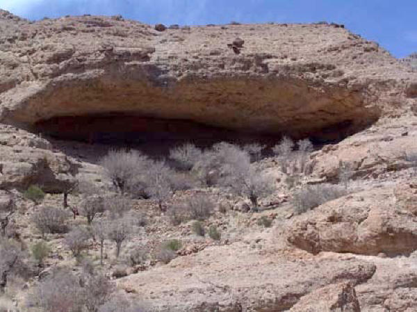
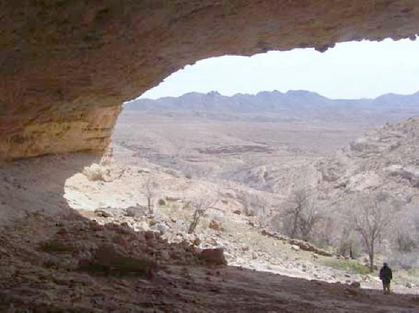
Another site with numerous petroglyphs is the Eshkaft grotto, eight kilometres north of Meymand / Maymand. The grotto, a shallow cave with a large mouth, is reached by travelling on a dirt road that heads northwest from the village and passes through the Lakheiss region in the Lakhorin heights. The road terminates at the foot of Tekhorin mountain in whose slopes Eshkaft is located. Visitors are known to light and place candles beside the rock art.
» Top
|
