Image credit: travfotos at Flickr
Page 1: Yazd Region
» Site Contents |
Further reading:
» Yazd Pilgrimage Sites
» Boteh (Paisley) & Aryan Trade
» Termeh - Heritage Fabric & Aryan Trade
» Kareez - Ancient Aryan Water Distribution System
» Yazdi-Zoroastrian Wedding Customs
» The Dari Language Project by Annahita Farudi and M. Doustdar Toosarvandani (pdf)
|
Yazd Province
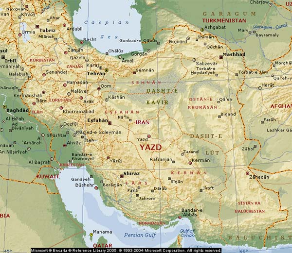
When the royal queen and princesses of the last Sassanian royal family fled before the onslaught of the invading Arab armies, they did so to the lands of Yazd. And in their footsteps would follow - over the next five hundred years - many other Zoroastrians who did not wish to subject themselves to Arab rule - from all over Iran. The lands of Yazd lie in the heart of Iran and today make up the province of Yazd.
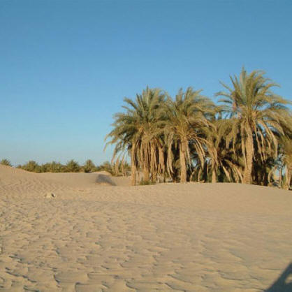
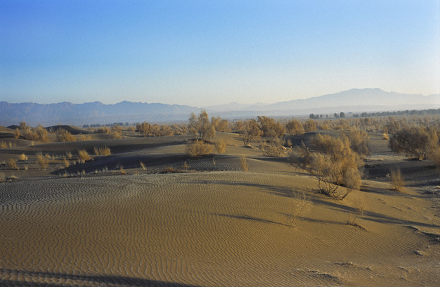
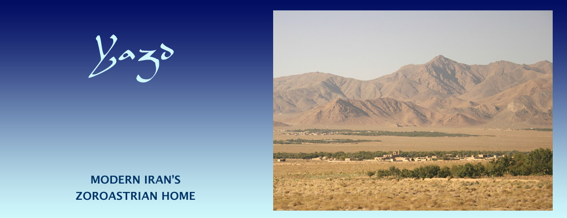
The city of Yazd itself was an oasis in an otherwise stark but hauntingly beautiful region, a feature that describes the entire province: barren mountains, deserts and patches of verdant greenery that dot the landscape (see the banner image above).
Ancient Habitation
|
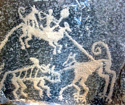
| Neolithic petroglyphs discovered near Ernan / Arnan village Found when excavating a kareez / qanat. Displayed at Yazd Water Museum |
Arnan Rock Art
Eighty kilometres southwest of Yazd city, in the slate rock of the Arnan height, thirty one rock art petroglyphs (scraped or scratched rock art) figures dating to the stone ages (the Neolithic) - that is some 4,000 to 12,000 years ago - were discovered were excavating a water channel called a kareez or qanat. The example shown here now resides in Yazd's Water Museum.
The rock art depicts, on three sides of a large rock, two scenes with animals being hunted by men with bows, spears and hunting dogs.
In addition to the Ernan / Arnan petroglyphs. stone tools have been found in the valley beside Mount Shirkuh, and pottery shards dating to the Elamite era have been discovered found in the Narin fortress' ruins near Meybod north of Yazd.
Yazd and Zoroastrian-Aryan History
We do not known for certain when Yazd entered Aryan or Zoroastrian history. Like Yazd's neighbour, the province of Pars - the seat of the Persian empire - Yazd appears to have become a part of the Zoroastrian Aryan lands after the Avestan canon - the texts that included in the Zoroastrian scriptures - was closed. However, there are some who identify Yazd with the land known in legends of the Pishdadian dynasty as 'sar-zameen Yazdan' meaning the 'headlands of the divine' or alternatively the 'abode of the angels'.
Yazd lies on the Aryan trade roads (the Silk Roads) and it very well have been under Aryan influence, if not a part of the Aryan lands, via the east - that is via Sistan and Kerman or from the north via Ragha, rather than via the west and the Persians.
Yazd city is one of the oldest continuously inhabited cities in Iran and is a world heritage site. Other Yazdi towns and villages also have ancient roots the legacy of which they carry in their names - names with roots such as Mehr (cf. Mehriz), Arda (Ardakan) and Mobed (Maybod).
The district of Mehriz is located south of the city of Yazd and east of Taft. Its main town, some 30 km south of Yazd city, is also known as Baghdadabad (Baghdad may mean 'gift, or given, by God' cf. bagha-dad). the name Mehriz is throught to be derived from Mehrnegar, daughter of Sassanid king Anooshirvan, and who reputedly was responsible for beautification projects around Mehriz that included the construction of kareez / qanat canals to bring in water. The name Mehrnegar is in turn associated with Mehr. The name of a village near Mehriz, Khormiz, is said to be derived from Hormoz.
South of Mehriz / Baghdadabad town, in the area around the Gharbal Biz spring (which is adjacent to the village of Madvar), excavations have revealed artefacts dating to the Achaemenian period. The site was one of the first to undergo archaeological excavations in Yazd province. The excavations have uncovered what is thought to be a Mithraic temple and graveyard dating to the Parthian and Sassanid eras. Recent discoveries have unearthed pottery dating to the Achaemenid era.
Forty kilometres from Aqda village near Gav-e Khuni swamp (also called (also Gavkhooni / Gavkhaneh Lake) on the border of Yazd and Isfahan provinces, archaeologists have discovered ruins on hill which they believe were once a Sassanid era (224-651 CE) traveller's way station on the road from Yazd to Esfahan. The swamp is where Zayandeh River that flows through Isfahan province terminates. It is a haven for wild birds and has a micro environment all of its own.
Zoroastrianism in Yazd and Kerman
In any event, the province of Yazd and its neighbour Kerman to the south-east became the main strongholds of Zoroastrians after the tenth century CE.
[The Arabs began their attacks on the Sassanian empire around 633 CE and the Iranian plateau in 642. The last Zoroastrian king of Iran, Yazdigerd (also spelt Yazdegerd, Yazdgerd and Yazdgird) III was murdered in 651 or 652 CE. Pars continued to be the centre of Zoroastrians in Iran until about the tenth century CE. An Abbasid official Abu Zaid al-Balkhi, quoted by Nyberg, wrote, "There is no country where the Zoroastrians are more numerous than in Fars." But that state of affairs was about to come to an end. Persecution of Zoroastrians in Pars, as well as the other powers centres of Iran such as Khorasan, increased, and groups of Zoroastrians fled to Yazd and Kerman.
Both Yazd and Kerman now became vital to the survival of Zoroastrian Aryan culture and traditions - traditions that find their home in the Zoroastrian scriptures, the Avesta - and this could not have happened by accident and without very strong ancient connections.
These pages are a tribute to the past and present Zoroastrians of Yazd and Kerman. The pages stand as testimony to their grit, perseverance and simple goodness. The Parsees of India, the Zoroastrians that had sought refugee in India after the Arab invasion, recognized this vital connection and came of the aid of the Zoroastrians of Yazd and Kerman in their darkest hours of persecution, humiliation and attempts at their annihilation. These pages stand as testimony to, and a reminder of, the strong bonds and cooperation between the Zoroastrians of Iran and India - bonds maintained over a thousand years of separation.
The special role that Yazd plays in Zoroastrianism and Zoroastrian cultures are very well portrayed in the videos produced by BBC, sections of which can be viewed below.
Video on Yazd. BBC's Taste of Iran series
The following video selections are an excellent introduction to Yazd. You can view the entire set of videos on our BBC's Taste of Iran page.
|
|
Landscape & Climate
Yazd lies atop the Iranian plateau and is bordered by the Zagros mountains on its west and great deserts to the north and east. To the south lies the similarly rugged province of Kerman. In our introduction, we had briefly described the landscape of Yazd as consisting of "barren mountains, deserts and patches of verdant greenery that dot the landscape." Many of the patches of green are made possible by the waters of melting snow brought down from the mountains in channels called kariz that stretch for kilometres.
The deserts, however are an ever-present reality and given the opportunity, the sand storms that blow across the deserts would soon swallow up any presence of human habitation.
Climate
The landscape and climate of Yazd are a direct result of the quantity of rain deposited in the province which lies in the rain shadow of the mountains that surround it.
As a result, Yazd is one of the driest provinces and Yazd city, one of the driest cities, in Iran. The mean annual precipitation across the province is about 100 millimetres, while the average in the city of Yazd is about 60 millimetres(2.4 inches) - most of which falls in the winter months.
July temperatures in Yazd city frequently rise above 400C and the average temperatures there are 390C for a high and 230C for a low. Given the distinct, almost 200C, cooling in the late evening and night, social summer activity during the Yazd summer takes place in the evenings. January is the coldest month with an average high in the city of 120C and a low of -10C. Since, these are average number, the temperature can very well drop below -10C.
|
Deserts
|
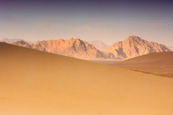
| The desert and mountains of Yazd. Image credit: Salar Motahari |
To the north of the province lies the great desert of the Iranian plateau, the Dasht-e Kavir, and to its east lies the other large desert of Iran, the Dasht-e Lut. The word 'dasht' means a desert. It also means any flat stretch of land with few if any trees such large fields, plains, grasslands, rolling meadows and moors. The Dasht-e Kavir is named after its salt marshes and salt flats, the kavirs, and Dasht-e Lut means the desert of emptiness.
In-between these two large deserts of Iran, the Dasht-e Kavir and Dasht-e Lut, lie the deserts of Yazd itself. Some consider these smaller Yazdi deserts as fingers of the two larger Iranian deserts. The province's deserts are:
- The Ardakan Desert which lies between the mountains of Hoosh (elevation 1,939 m.) in the south, and Siyah Kuh (black mountain, elevation 2,050 m) in the north;
- The Abar Kuh Desert, a circular desert area demarcated by two mountains adjacent to the Taqestan desert;
- The Taqestan desert;
- The Daranjir Desert to the east of Yazd and with an area over 1,500 square kilometres;
- The Herat and Merosat deserts, approximately 500 square kilometres in size;
- The Behesht-abad desert that runs between the towns of Anar and Rafsanjan from the northwest to the southeast;
- The Bahadoran desert to the southeast of the town of Mehreez and which extends in a northwest to southeast direction, and
- The Saqand, Haji-abad and Zarrin-abad deserts.
Mountains
Shir-kuh (milk-mountain) at an altitude of 4075 metres is the tallest mountain in Yazd. It has snow at its peak throughout the year. Shir-kuh lies south of Yazd and the neighbouring town of Taft. The environs and villages around Shir-kuh are popular as a summer retreat from the plus 400C temperatures in Yazd city.
Caves
Yazd has a several well known caves (ghar) with interesting geological, stalagmite and stalactite formations. Many of the caves that Zoroastrian connection with some serving as pilgrimage site. The presence of numerous caves gives us hope that in one or more, some long lost Zoroastrian texts or other artefacts may be hidden waiting to be discovered. Among the better known are the Katarkhoon cave about 100 km south of Yazd; the Nabati cave in Nodoushan, near Badnar, west of Nasrabad and Taft; the Eshgeft-e Yazdan cave, Mobadan-e Firooz cave, the Ala cave, the Chak-Chak cave and the Islami-ye cave.
Springs
Some of the oasis and patches of green that dot the otherwise arid Yazdi landscape are watered by springs among which are the springs of the Gharbal Biz spring at Mehriz, the Tamehr spring in Taft, and the Masih spring in Herat.
Silk Roads and Macro Polo
Marco Polo, travelling the Aryan trade roads called the Silk Roads passed through Yazd in 1272 CE. He arrived in Yazd at about the time that Zoroastrians had been reduced to a minority in their ancestral lands, but who nevertheless still asserted a considerable presence. Polo described the city as good and noble, and took note that city was noted for its silk production.
"Yazd also is properly in Persia; it is a good and noble city, and has a great amount of trade. They weave there quantities of a certain silk tissue known as Yazdi, which merchants carry into many quarters to dispose of... . When you leave this city (Yazd) to travel further, you ride for seven days over great plains, finding harbour to receive you at three places only. There are many fine woods [producing dates] upon the way, such as one can easily ride through; and in them there is great sport to be had in hunting and hawking, there being partridges and quails and abundance of other game, so that the merchants who pass that way have plenty of diversion. There are also wild asses, handsome creatures. At the end of those seven marches over the plain you come to a fine kingdom which is called Kerman." (The Travels of Marco Polo, by Marco Polo, translated by Henry Yule).
Two of the better known silk products are its silk carpets and a silk fabric known as a termeh, and which often employs the boteh (now in the west as paisley) motif.
Bazaar of Yazd
The bazaar of Yazd would have been a destination of many a trader along the Aryan trade roads (Silk Roads). We do not know what the original bazaar of Yazd look like or where it was located. The surviving bazaar with historic roots called Qeisariyeh is located just south the old city and outside the old city's walls. Entrance is through two large wooden gates. The bazaar is divided into sections specific to a particular trade some of which house the workshops of artisans. The bazaar closes down during the hot afternoon hours and reopens in the late afternoon. The busy hours are the evening hours.
City of Yazd
|
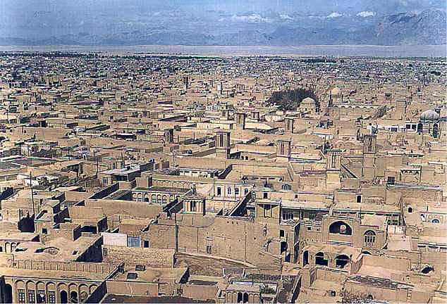
| Sand coloured Yazd skyline with mountains in the background. Image credit: various |
Yazd city, the capital of Yazd province, is a modest sized city with a population of about 400,000 people.
Yazd city was originally an oasis at the crossroads of the the Aryan trade roads, and one that became renowned as the centre for the regions silk and wool fabrics. The city sits atop the Iranian plateau at between 1203 and 1238 metres above sea-level.
Sand storms regularly blow from the north through the city. Their approach is heralded by the sky turning a dark red or yellow and by the time the storms recede, they deposit sand up to a finger length deep. To hold back the encroaching desert, the people of Yazd have planted thousands of tamarisk / gaz trees around the city to its north. Gaz or tamarisk was at one time the main constituent of the barsom bundles used in Zoroastrian worship. Tamarisk is a hardy tree and can survive long periods of drought. The tree an its resilience are a fitting metaphor for the Zoroastrian Yazdis and the barsom bundle made up of thin supple branches is strong and unbreakable when united as a bundle.
Names of Yazd City
The word Yazd is related to the Avestan word Izad meaning divine. We are told that the Greeks knew the city of Yazd as Isatis, a city constructed on top an older city called Katteh or Kaseh. We are further told that after the Arab invasion of Iran, the city was known for a while as Darol'ebadeh.
The city of Yazd has been nicknamed as the Crossroads of Iran, the Bride of the Desert, the Pearl of the Desert, the City of Badgirs meaning the City of Wind-Catchers.
City Walls
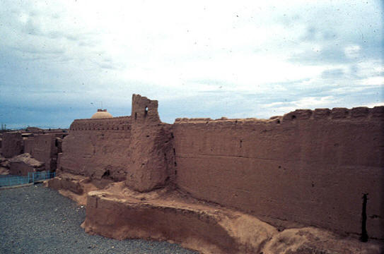 |
| A less well preserved section of the city walls. Image credit: Archnet Digital Library |
The Shahr-e Koneh or old city of Yazd was surrounded by protective fortification walls. Jalal'e al'e Ahmad lamented in his travelogue Yazd dar safarnameha that unregulated development has done more harm to the old city of Yazd than previous conquerers. To accommodate the building of the new city, the Shahr-e Now, large portions of the city walls were demolished in the Pahlavi and present day Republican periods, to accommodate urban growth and expanding traffic routes. Today, sections of the surviving walls show eroded crenels (the openings in battlements or the rectangular openings) on the top of the ramparts. There is also deterioration and erosion of the lower base of the walls caused by water seepage and human activity.
As bad as this senseless expedient destruction has been, the destruction of historical buildings and construction work in other part of the country has been far worse and the surviving walls of Yazd city are still among the finest expressions of a vital tradition of military architecture in Central Iran.
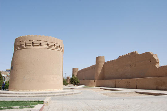 |
| A portion of the city walls of Yazd. Image credit: Jenny Brophy at Flickr |
Yazd has been a fortified city since at least the Sassanian period (c. 200 - 649 CE). The walls were built largely of mud brick and a mud-straw mixture reinforced with timber, had iron gates known as Kathah. The walls had protected crenels with arrow slits provided defensive positions while series of sluices allowed invaders to be discouraged by boiling oil or burning pitch. The walls were double layered with a high protective external curtain supported by a lower inner wall. The hollow space sandwiched between accommodated tiered firing galleries that allowed different firing angles and range for defending armies. This method of construction is very similar to the construction of fortresses in Khvarizem.
Today only sections of the old city walls - built in 1033 CE by Ala ud Daulah Kakoui of the Kakoui dynasty, with additions in 1346 CE and later in the 1390s - can be seen standing. The siege and occupation of Yazd by Timur in 1393 CE brought about the single largest rebuilding of the city walls that have survived. He had entire portions of the city's southern wall to be replaced, strengthened and extended with new barbicans. Contrary to his reputation as a pillager and destroyer, Timur is said to have exempted Yazd from taxes. He also ordered the undertaking of a large urban building program.
