Contents
Far Eastern Lands
|
Page 1: Tashkurgan, Khotan, Yarkand, Tochari. Phryni & Seres
Related reading:
Eastern Extent of Iran-Shahr
Tashkurgan, Kashgar, Khotan, Yarkand, Turfan, Tochari
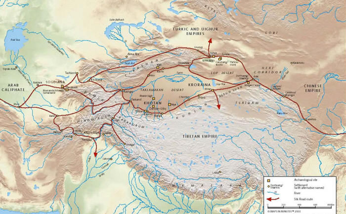 |
| Aryan trade roads (Silk Roads). Note Kashgar and Yarkand in Khotan |
The Shahnameh of Ferdowsi placed Chin (China) to the east of Airan and also to the east of Turan (Sugd). That Iran-Shahr, the traditional lands of the Iranian-Aryans extended to the east - almost to the gates of Chin (ancient China), is an often neglected fact - perhaps since the dominant of the Iranian kingdoms was Persia in the southwest of Iran-Shahr, and that is where classical Greek writers focused their attention. They do, nevertheless, describe two lands to the east of the Syr-Darya (Jaxartes) River that were part of the Bactrian empire: Phryni & Seres.
The eastern-most lands that from time-to-time became part of the Iranian-Aryan sphere of influence, would in modern times come to be known as Eastern Turkistan. The pattern of historical change appears to be as follows: The Iranian Saka lands and the lands to the east of them were occupied by a Turkic peoples (Afghanistan and Tajikistan being exceptions). When the leadership of these peoples converted to Islam, the population of the lands converted to a large extent as well. The rough extent of previous historic Iranian, Iranian-controlled (control fluctuated), or Iranian-influenced lands can be seen today as those whose populations now embrace Islam. In present-day China, this includes parts of Eastern and Southern Xinjiang Uygur province up to about Khotan/Hotan in the south and the Tarim Basin in China's Xinjang (Xinjiang) province. Coins minted by Kushan King Kanishka have been found in Khotan and the Tarim Basin was home to the Tochari, the easternmost speakers of Indo-Iranian languages in antiquity. Evidence of
Sogdians living in Turfan in the Tarim Basin have been discovered.
We do known that the far reaches of the Iranian empire if not Iranian influence and culture extended to (in the words of Sir George Rawlinson in his Seven Great Monarchies), to "the Pamir Steppe, or on the high plain of Chinese Tartary, east of the Bolar range - the modern districts of Kashgar and Yarkand." Kashgar / Kashi and Yarkand in Khotan and presently in the northeast corner of China's Xinjang (Xinjiang) province, were important terminals on the Aryan Silk Roads. Click here for Photographs of Kashgar.
The Eastern Iranian Pamiri dialects of Sarikoli and Wakhi are spoken across the present Tajik-China border in the Xinjang (Xinjiang) province of China and where the Kunlun Mountains form part of the Pamir knot. This is where we find the autonomous region of Tashkurgan, a region still populated by ethnic Tajiks and Kashgar / Kashi.
The residents of Tashkurgan and Kashgar were known to have practiced Zoroastrianism and the ruins of a Zoroastrian temple can be found beside the ruins of an ancient fortress in Tashkurgan. Indeed, it is possible that some of the residents of areas in China that practice Islam today could have practiced Zoroastrianism in the past. The original Indo-Iranian inhabitants of this area have to a large extent been displaced by Turkic peoples.
Achaemenian Era (700-330 BCE) Eastern-Most Persian-Iranian Lands
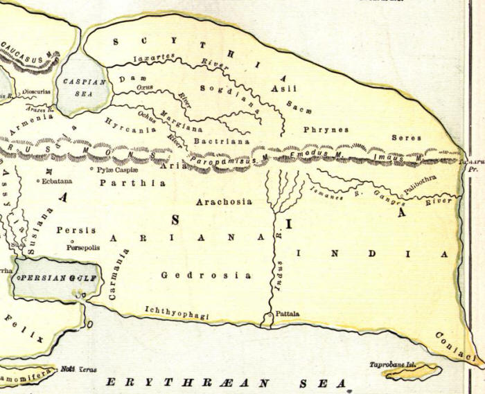 |
Central and East Asia. Map based on Strabo quoting Eratosthenes. The Emodus is the Himalayas and the Imaus
likely a branch of the Pamirs. Note Phrynes and Seres as being north of the Himalayas. |
Phryni & Seres
Strabo in Geographia 11.11.1 states, "Apollodorus (of Artemita, a Hellenic writer of the 1st century BCE) in short says that Bactriana is the ornament of all Ariana. They extended their empire even as far as the Seres and Phryni."
Classical Hellenic authors place Seres and Phryni in a direction east of Bactria and north of India. Little else is said about the Phryni.
Phryni, Tashkurgan & Kunlun Mountains
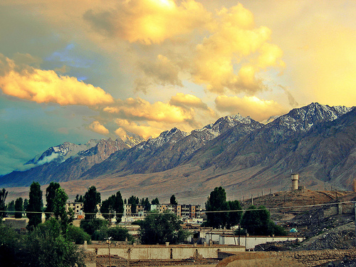
In the map above, we see the Saka to the north of Phryni. The eastern Pamirs slopes of Tashkurgan are a good candidate as the home of the Phryni.
Tashkurgan is where the Kunlun, Kara Kunlun, Hindu Kush and Tian Shan mountains come together. It is connected to the Wakhan Corridor now in Afghanistan, to the Pamirs now in Tajikistan (Gorno-Badakhshan Province) and the upper Hapta-Hindu, the upper basins of the Indus and its tributaries now in Pakistani-administered Kashmir (Gilgit-Baltistan). The Kunlun mountains are an eastern stem of the Pamirs. It is the eastern-most surviving Aryan enclave today. Its people are the only group within China that speak
Sarikoli, a South-eastern Iranian language related to Avestan and Sanskrit.
Given its pivotal location that we have just described, Tashkurgan was also an important junction on the Aryan trade roads also called the Silk Roads.
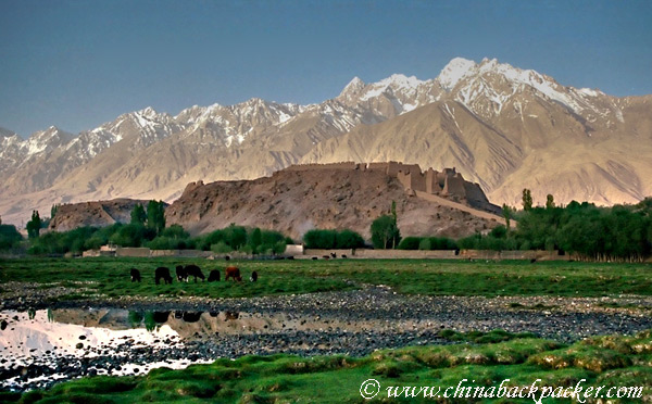
At the northeast corner of Tashkurgan town is a large fortress sitting on a hill that dominates the valley around it. The present citadel is known as the Princess Castle and dates from the Yuan Dynasty (1277-1367 CE). Ruins identified as a Zoroastrian temple are located near the fortress.
Tashkurgan/Taxkorgan means Stone Fortress or Stone Tower. Historically the town was also called Sarikol (سريكال) or Sariqol (سرقول) and as Varshadeh. Present tradition of Sarikol speaks of King Afrasiyab, the legendary king of Turan in the Shahnameh, as the founder of Varshadeh. Today, Tashkurgan is called the Tajik Autonomous County of the Kashgar Prefecture in western Xinjiang, China. The name Sarikoli and Sacarauli (see above) are similar and the similarity bears further investigation.
If Tashkurgan / Sarikol was not Phryni, we would have to find another ancient ethnic group or nation with which to find congruence.
Also see
Ancient Khotan by M. Aural Stein.
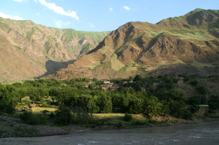 |
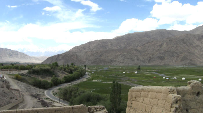
| Tashkurgan valley. Image credit: roddo.net |
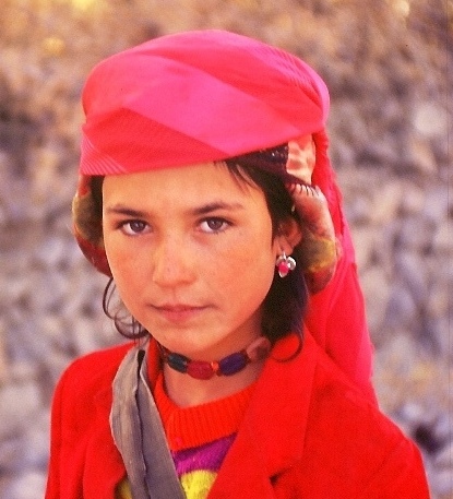 |
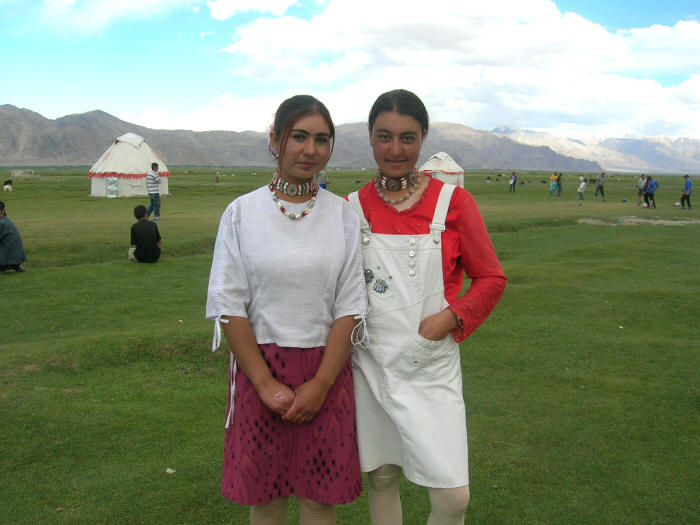
| A Tajik girl in Tashkurgan. Image credit:
dim sum |
Seres
The first available account of the Seres, is attributed to the 5th cent. BCE Greek historian Ctesias who in a manuscript found only in the Bibliotheca, refers to them as "people of portentous stature and longevity." Similarly, Strabo in Geographia 15.1.34 states, "the Seres, however, are said by some writers to be still longer lived than the Indians whose "life is protracted even to the age of 130 years, that they are temperate in their habits and healthy." In 15.1.37, Strabo states, "All the country on the other side of the Hypanis* is allowed to be very fertile, but we have no accurate knowledge of it... of the longevity of the Seres, whose lives exceed the age of two hundred years."
[The segment of *Beas or Biyah / Sutlej (a river in north India and a tributary of Chenab which in turn runs into the Indus) that runs west-east into the Himalayas. Directly north of this segment is Kashmir, to the northwest of which lies the Pamirs.]
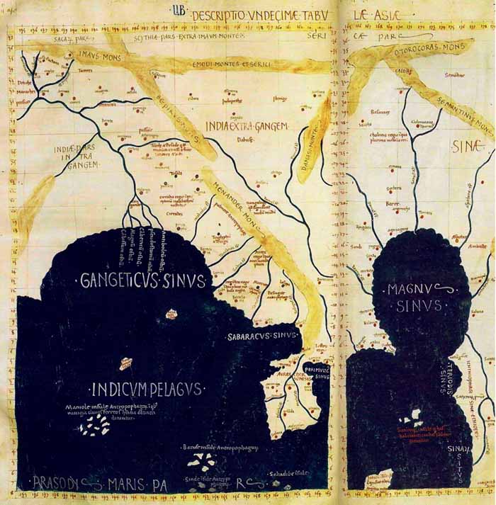
Hellenic knowledge of the eastern reaches of the Persian Empire did not exist until Alexander's conquest of the empire. His advance halted at the eastern extremities of the then Persian Empire: India, Fergana and Saka lands bordering the Jaxartes River. Thus Pomponius Mela in De Situ Orbis I.2, notes, "In the furthest east of Asia are the Indians, Seres, and Scythians. The Indians and Scythians occupy the two extremities, the Seres are in the middle." Similarly, Ptolemy, a Roman, who in Latin calls the chief city of Seres, Sera and the country Serice/Serica** states in Geographia, "The inhabited part of our earth is bounded on the east by the Unknown Land which lies along the region occupied by the easternmost nations of Asia Major, the Sinae (China) and the nations of Serice." Further, "The eastern extremity of the known earth is limited by the meridian drawn through the metropolis of the Sinae (China - note the difference between Serice and Sinae. China and Seres are not the same)." [**Note: Serica appears to mean the 'land of silk' and is connected with Serer, those connected with trade in silk. Ferdinand Freiherr von Richthofen (1833–1905) a German traveller, geographer, and scientist is credited with coining the term Seidentrasse meaning Silk Road in his China, Vol. I (1877), identifies Serica with the Tarim / Yarkant Basin i.e. Khotan.]
Pomponius Mela (1st cent. CE Roman geographer) in De Situ Orbis III.7, speaks of the character of the Seres: "The Seres..., a people eminent for integrity, and well known for the trade which they allow to be transacted behind their backs, leaving their wares in a desert spot." Similarly, Pliny (at The Natural History 6.24) says, "It was to the effect that the merchandize on sale was left by them upon the opposite bank of a river on their coast, and it was then removed by the natives, if they thought proper to deal on terms of exchange."
Pliny the Elder, The Natural History, translation by John Bostock 6.20 reads: The Seres are of inoffensive manners, but, bearing a strong resemblance therein to all savage nations, they shun all intercourse with the rest of mankind, and await the approach of those who wish to traffic with them (they are open to traders and travellers but not traders and travellers themselves).
Pliny 6.20 contd.: The first river that is known in their territory is the Psitharas, next to that the Cambari, and the third the Laros; after which we come to the Promontory of Chryse, the Gulf of Cynaba, the river Atianos, and the nation of the Attacori (the Uttarakuru north of the Himalayas in Hindu/Buddhist literature ?) on the gulf of that name, a people protected by their sunny hills from all noxious blasts, and living in a climate of the same temperature as that of the Hyperborei.
Pliny 6.20 contd.: Amometus has written a work entirely devoted to the history of these people, just as Hecatśus has done in his treatise on the Hyperborei. After the Attacori, we find the nations of the Phruri and the Tochari (Tarim basin, Khotan), and, in the interior, the Casiri (Kashmiri?), a people of India, who look toward the Scythians, and feed on human flesh. Here are also numerous wandering nomad tribes of India. There are some authors who state that in a north-easterly direction these nations touch upon the Cicones and the Brysari. [Our note: This section describes the Indian Kashmiris and their neighbours to the north, the, Tashkurgan and Khotanese.]
Pliny 34.4141: Of all the different kinds of iron, the palm of excellence is awarded to that which is made by the Seres, who send it to us with their tissues and skins; next to which, in quality, is the Parthian iron.
In our estimation, Serica, the land of the Seres was located around the eastern Tarim / Yarkant basin today in China's Xinjiang Uyghur Autonomous Region. As we have stated above Phryni could have been its neighbour in the Pamirs or Tashkurgan. Serica would have extended up to the western extremity of the Great Wall of China which was the border of Chin (Tsin) in ancient times.
Silk Production
What made Seres (Serica) famous was its fabric, made from either silk or cotton and Seres means 'of silk' in Latin and Greek. The fabric was so noteworthy so as to find mention as a fabric worn by Cleopatra (in the mind of the author) in B. x. 141, of the Pharsalia, by Lucan: "Her white breasts are resplendent through the Sidonian fabric, which, wrought in close texture by the sley of the Seres, the needle of the workman of the Nile has separated, and has loosened the warp by stretching out the web." According to Henry Yule (1820-1889, translator of the Marco Polo's travel account) quoting Pliny and Ptolemy states that Seres, "within the confines of Bactria" were known for "silk stuffs, furs, and iron of remarkable quality."
This feature of silk-production leads many authors to speculate wildly (fuelled by Ptolemy's longitude speculations) that the nation referred to is China. But China is listed by Hellenic authors separately as Sinae. Some authors have even suggested the region of modern-day Kashmir. However, Kashmir was very much a part of the upper Indus i.e. Hapta Hindu and was on the south side of the Himalayas, while Seres was north of the Himalayas and perhaps north of a branch of the Pamirs as well. Lands east of Fergana, say Khotan, are a more likely candidates. While China is popularly known for its silk, silk was collected and woven in all these districts. Cotton was grown and wool used as well. The behaviour of shyness when trading with newcomers is a trait ascribed to the Chinese (the Chinese traders were not renowned as travellers as were the world travelling Aryan Sogdians). Perhaps the Khotanese were shy as well.
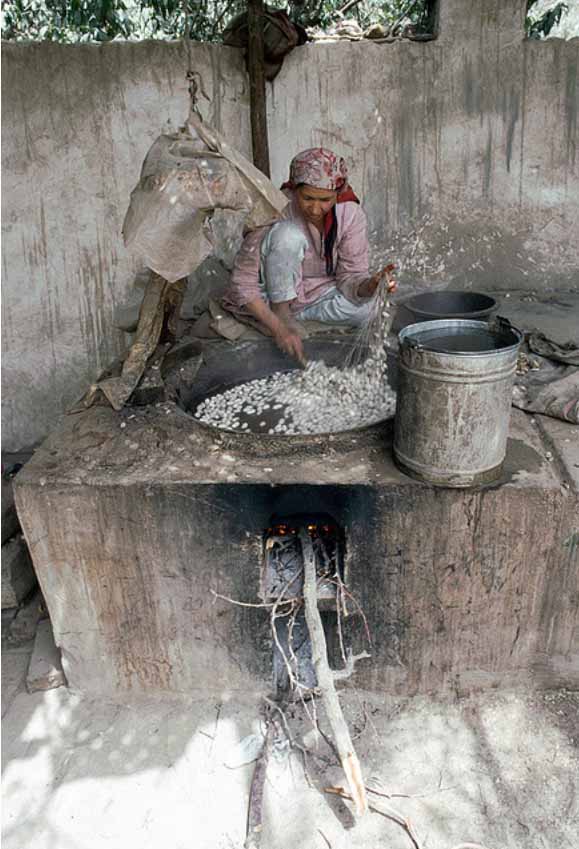
Pliny the Elder, The Natural History, translation by John Bostock 6.20 reads: The first people that are known of here are the Seres, so famous for the wool (silk?) that is found in their forests. After steeping it in water, they comb off a white down that adheres to the leaves; and then to the females of our part of the world they give the twofold task of unravelling their textures, and of weaving the threads afresh (this describes silk thread extraction). So manifold is the labour, and so distant are the regions which are thus ransacked to supply a dress through which our ladies may in public display their charms.
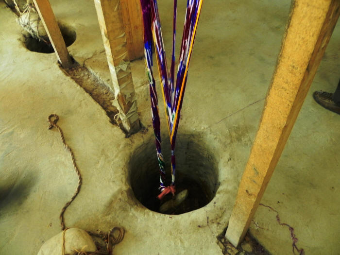 |
| Silk thread hanging in Khotan |
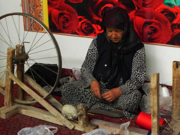 |
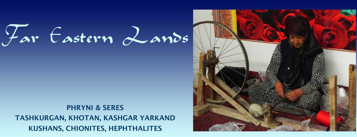
| Silk thread spinning wheel in Khotan |
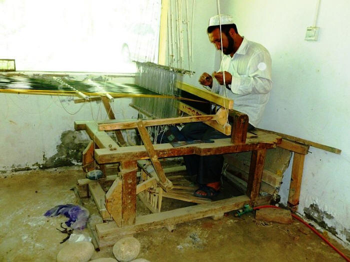 |
| Silk fabric weaving in Khotan |
Related reading:
» Top
|
|
