Page 2

Contents
|
Dahi - Iranian Friend or Foe?
We have noted above that the Dahi are mentioned in the Avesta with great reverence - reverence to the souls of Dahi's women and men. Given that the Avesta does not hesitate to condemn the Daevayasni, the people who worshipped the daeva, the reverence given to the women and men of Dahi country - the entire country - indicates strongly that the Dahi supported and embraced Zarathushtra's message and were Mazdayasni, worshippers of God.
From the classical Greek accounts in the section above, we also note that the Dahi were Iranian allies in no uncertain terms.
The Encyclopaedia Iranica also states that "in various classical sources the Dahae are listed in the rosters of the Persian army that fought against Alexander the Great at Gaugamela. Arrian (Anabasis 3.11.37) reported that the Dahae fought in the left wing, together with the Bactrians and the Arachosians. Curtius Rufus (4.12.5ff.) also placed the Bactrians and Dahae in the left wing. In addition, both authors noted that beyond the Persian ranks, at the extreme left, there were Bactrian and Scythian cavalry and Scythe chariots (Arrian), or the Massagetae (Curtius Rufus). It is thus clear that the left wing of the Achaemenid army was formed by troops from the north-eastern part of the empire, predominantly of Scythian descent, and that the Dahae were one of these groups." Here we see that the Dahae were allies and integrated as part of the Iranian forces.
Nomadic Daha / Dahi
 |
The Turkmen Nomads of Gorgan's Turkmen Sahra (desert). A Jafarby Yomut woman beside her
qara-gotikma (yurt-like tent), a simpler, and therefore easier to transport form of a qara-oy
used by the nomads near lnchc Borun. Image Credit: Farzad Marjani |
Much is made of the Dahi being Scythian nomads and the Zoroastrian preference of settled life. Not all Saka Scythians were nomads. Depending on the location many were settled. As a generalization, we can state that the further north from the upper reaches of the Syr and Amu Darya rivers we go, the less fertile is the land and the more nomadic the people. The climate in the region did change some five to three thousand years ago - it became more arid, and fertile farm land would have changed to the 'wastes' described by Appian. The climate change coupled with the inevitable struggle between groups might have forced a migration or an attendant change in lifestyle.
After the Dahi migration west to the Caspian, some of the Dahi would have found arable land beside the river Atrek. In the northern lands that came under their rule, the natives could have been nomads. As such, the Dahi lands, medieval Dahistan, could have been home to southern settled and northern nomadic peoples.
Strabo's str in 11.8.3 states, "Between these people (the Dahae), Hyrcania, and Parthia as far as Aria lies a vast and arid desert, which they (the nomads) crossed by long journeys, and overran Hyrcania (Varkana), the Nesęan (Nisa) country, and the plains of Parthia. These people agreed to pay a tribute on condition of having permission to overrun the country at stated times, and to carry away the plunder. But when these incursions became more frequent than the agreement allowed, war ensued, afterwards peace was made, and then again war was renewed. Such is the kind of life which the other nomads also lead, continually attacking their neighbours, and then making peace with them."
The raiders respected no agreement and were relentless in their raids. Their appetite for plunder, raping and sodomizing seemed insatiable. The Dahi nomads or nomads that passed through Dahi lands on their raids to the south, were part of the devil's army in the eyes of the Iranians.
One of the Iranian responses was to build a defensive wall - the Wall of Gorgan - similar to the Great Wall of China. As with the Chinese wall, the Gorgan wall was intended as a barrier against hostile forces and raids from the north. To the north of the wall lies Dahistan, the land of the Dahae.
All the communitties of the region, Parthav (Khorasani), Gorgan and Dahi, consisted of settled, semi-nomadic and nomadic peoples and this mixture exists to this day - all living peaceably with one-another.
 |
| Northern Khorasani nomads. Note poppies. Image Credit: Khoosheh-Chin |
|
Settled Dahi
As we have noted previously, the Saka were not all nomadic raiders. Saka society consisted of both peoples settled in cities, farmers (those near fresh water sources such as the Amu Darya) and the grassland nomads. This is evidenced by archaeological discoveries all the northern Amu Darya (Oxus) river and it confluence with the Aral Sea, as well as discoveries in Dahi-land (Dahistan) immediately north of the Atrek river in what is Turkmenistan today, and what was Dahistan in medieval times.
The Dahi-land discoveries showcase a thriving culture at the end of the second and first quarter of the first millennium BCE (V. M. Masson, History of Civilizations of Central Asia, p. 373.) The Dahi land between the lower Atrek river extending some 100 km to the north is not naturally watered and green as is the land on the river's south bank. The Dahi constructed a network of canals some 50 to 60 km in length. The ruins of these canals have been discovered near Izatkuli and Madau-depe.
The settlements had foundries as evidenced by iron slag. The metal objects found include a variety of iron and bronze artefacts including leaf-shaped and twin-bladed, conical or three-bladed and hafted arrowheads. One bronze sword has a square grip and ribbed blade. Metal knives were used along with flint flake tools to make composite sickles. Much of the pottery such as tableware and fine vessels were made using pottery wheels, a sophisticated mechanical development.
A variety of pots, cups and beakers have spouts including bowls on saucers with long curving spouts. Also found were cups with black slips and three feet. Handles were attached by fluting. Of particular quality - and always of interest to Zoroastrians - is a (fire) censer with a bowl-shaped body and a cylindrical foot. The artefacts show a cultural link with the Shah-tepe and Turang-tepe Gorgan-Mazandaran region
Dahistan
 |
Caravan route (Silk Roads) section passing through Dahistan.
Section between Dahistan-Parthava-Sistan-Merv-Khvarizem
Base line map Credit: Trade Routes Resources. Notations K. E. Eduljee © |
In Medieval times, the land of the Dahi, the region immediately north of the Iranian provinces of Golestan (old Varkana) and North Khurasan (old Parthav), came to be known as Dahistan. In the literature we sometimes read the province of Golestan or Gorgan itself referred to as Dahistan. Confirming the location, Universal Geography states that "Dahistan, the country of the ancient Dahi" bordered Khorasan in medieval times. E. J. Brill's First Encyclopaedia of Islam (1913-36), Vol. 2, by Martijn Theodoor Houtsma, also states "The district watered by the lower course of the Atrek on the north side was called Dahistan in the middle ages (perhaps from the Dahs, an ancient people)."
Another medieval writer, Tabari mentions the City of Dahistan as being 23 farsakhs (120-160 km) from Gorgan and 5 farsakhs (30-40 km) from Buhaira - a coastal port or island on the eastern Caspian coast.
Regarding the prosperity of Dahistan, Brills Encyclopaedia quotes 10th century writer Mukhaddasi (c 985 CE) as "know(ing) Dahistan as a flourishing district, the richest in Gorgan with its capital in Akhur and 24 villages." The Dahi participated in the ancient occupation of trade with the known world and some important trade routes passed through Dahistan (see map to the left).
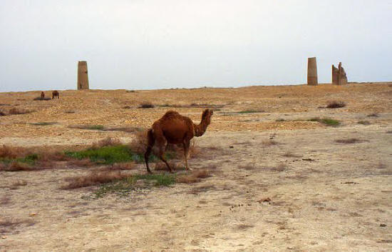
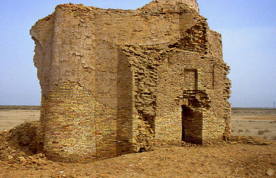
There was also a settlement called the Ribat of Dahistan situated on the edge of the steppes facing the Karakum (Garagum) desert mentioned in the medieval texts. The Ribat too had fine buildings and rich bazaars. There was some ruins of a settlement known as Mashhad-e Misriyan (now in Turkmenistan) that may be the Ribat.
Brill's Encyclopaedia also states, "Now there is to be found there the ruined town of Mashhad-e Misriyan, usually called Mestoryan on maps; water was brought to this town from the Atrek and even farther from the Sumbor (over 35 miles)." Other references place Mashhad-e Misriyan north-west of the confluence of the Atrek with its right bank tributary the Sumbar, some 70-100 km NW on the road that runs from Chat at right angles to the road that connects Gikishler to Aydin.
Currently, there are ruins called Misriyan at 38o 15'N, 54o 37'E. The site is 120 km NNW of Gonbad-e Qavus, 155 slightly east of north from Gorgan city, and 70 km east of the coast. There is another site named Mashad Ata just to the north.
 |
| Satellite image of the Mashhad-e Misriyan ruins' site. Credit: Google Earth |
|
Misriyan was likely a frontier fortress on the border of traditional Iran Shahr. The fortress and its city were destroyed by the Kalmuk Tartars in the 1600s. [Variants of the name Mashhad-e Misriyan include Mestorian, Mestoriana, Mestoryan, Mest-Debran, Mest-Dovran, Mastan, Messerian]
The ancient border later became the border between Iran and Russia. Reminiscent of the ancient Iran-northern Scythian competition for the borderlands, in 1882, when Russia compelled Iran to pull back its border to the Atrek river.
References
Jus. Marcus Justinus (3rd cent. CE) in Epitome of the Philippic History of Pompeius Trogus, translated by the Rev. John Selby Watson (London, 1853).
Isi. Parthian Stations (Mansiones Parthicae) was written sometime between 29 and 1 BCE. It lists all the supply stations, that is caravanserais maintained by the Parthavi (Parthian) Government for the convenience of merchants travelling along the caravan trail from Antioch, today a Mediterranean port in the southwest corner of Turkey, to the borders of India. With liberation from Macedonian rule, the Iranian-Aryans once again asserted control and facilitated trade along the Silk Roads.
Str. Strabo (ca. 63/64 BCE - 24 CE) Geography, translated by H. C. Hamilton, Esq. and W. Falconer, M.A.
Pol. Polybius (c 200-118 BCE) The Histories, was a Greek historian of the Hellenistic Period whose book covered history of the period of 220-146 BCE
Additional reading: » The Seven Great Monarchies, Vol. 6, Parthia by George Rawlinson
» Previous page
» Top
|


